SWERA
Social Work and Environment for Rural Advancement
Area Profile
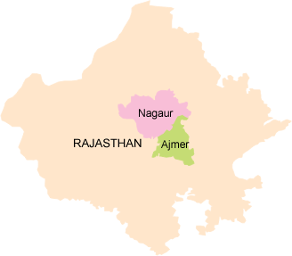
Ajmer District has an area of 8,481 sq km, and a population of 2,584,913 (2011 census). The district is situated in the centre of Rajasthan, and is bounded by Nagaur District to the north, Jaipur and Tonk districts to the east, Bhilwara District to the south, and Pali District to the west. It is divided into eight blocks and SWERA works in three of the eastern blocks, Srinagar, Silora and Arain.
The eastern portion of the district is generally flat, broken only by gentle undulations, but the western parts, from north-west to south-west, are intersected by the great Aravali Range. Many of the valleys in this region are sandy deserts, part of India's Thar Desert, with an occasional oasis of cultivation, but there are also some very fertile tracts; among these is the plain on which lies the town of Ajmer.
Although close to Ajmer city, the work area of SWERA is backward socially and economically.
Ajmer falls under the semi-arid region and the rainfall is generally low and also highly variable. The soils are mostly rocky with some areas of alluvial soil.
The district has a population density of 305 persons per sq km., which is high as compared to 165 of the state.
The annual exponential growth rate of the district during 1991-2001 is 0.02319 per cent, which is lower than that of the state 0.02494. About 41 per cent of the population of the district lives in urban areas. The sex ratio of the district is 932 females per 1000 males, which is slightly higher than that of the state average of 922. The literacy rate (population age 7+ years) of the district is 65.06 per cent, with 79.96 per cent for males and 49.10 per cent for females, which are slightly higher than the respective rates of the state.
However the situation in the target area of SWERA is generally worse than that in the district as a whole. SWERA has done a survey of the 25 villages and according to the primary data collected the population is predominantly of the OBC communities (Rawat, Jat and Gujar) with sizable numbers of SC communities (Bairwa, Reger and Balai). The Muslim communities are found in small numbers in most villages but also comprise an entire village, Jilawada. There are very few tribals sprinkled among the villages. The average size of a family is 6.6.
The major livelihood system is agriculture with animal husbandry playing a supplementary role. Most of the people are small land-owners with between 2-6 bighas of land and a small percentage of landless and big farmers. Almost all the agriculture is rain fed with only a few bigger farmers having irrigated land. All the irrigation is from tube wells.
Because of recurrent drought, the farming system is under tremendous pressure and in most years does not provide all the families, with the exception of a few big farmers have to migrate in search of labour income to supplement their agricultural produce.